Toggle How To Use
How To Use
key
Filter
Now click the map where you'd like to add something
| Local Nature Conservation Site |

|
| Garnock Connections Area |
|
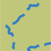
| Cycle Path |

|
| Footpath |
|
| Train Station |

|
| Bus Stop |
|
| Parking |
|
| Ferry |
|
| Playpark |
|
| School |

|
| Gurdwara |

|
| Park |
|
| Library |

|
| Cemetery |

|
| Church |

|
Click to close
How To Use
- Read a Marker Click a marker Tap a marker
- Zoom Scroll wheel/trackpad or use top-right controls Pinch or use top-right controls
- Move the Map Click and drag Touch and drag
- Rotate / Adjust Camera Angle Right-click and drag
- Rotate Swivel with 2 fingers
Click to close
 Warning & Access Tips
 Points of Interest
 Trails